
Archeology Case Study
CASE STUDIES
about this project
Archeology & Geotech: Understanding the grounds at Valley Forge National Historical Park Survey
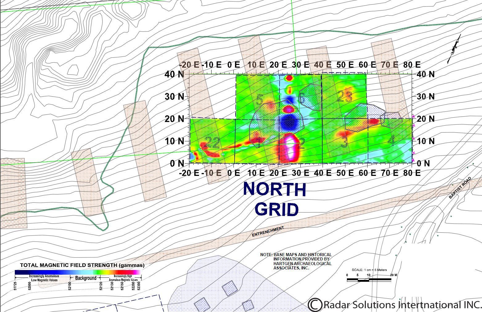
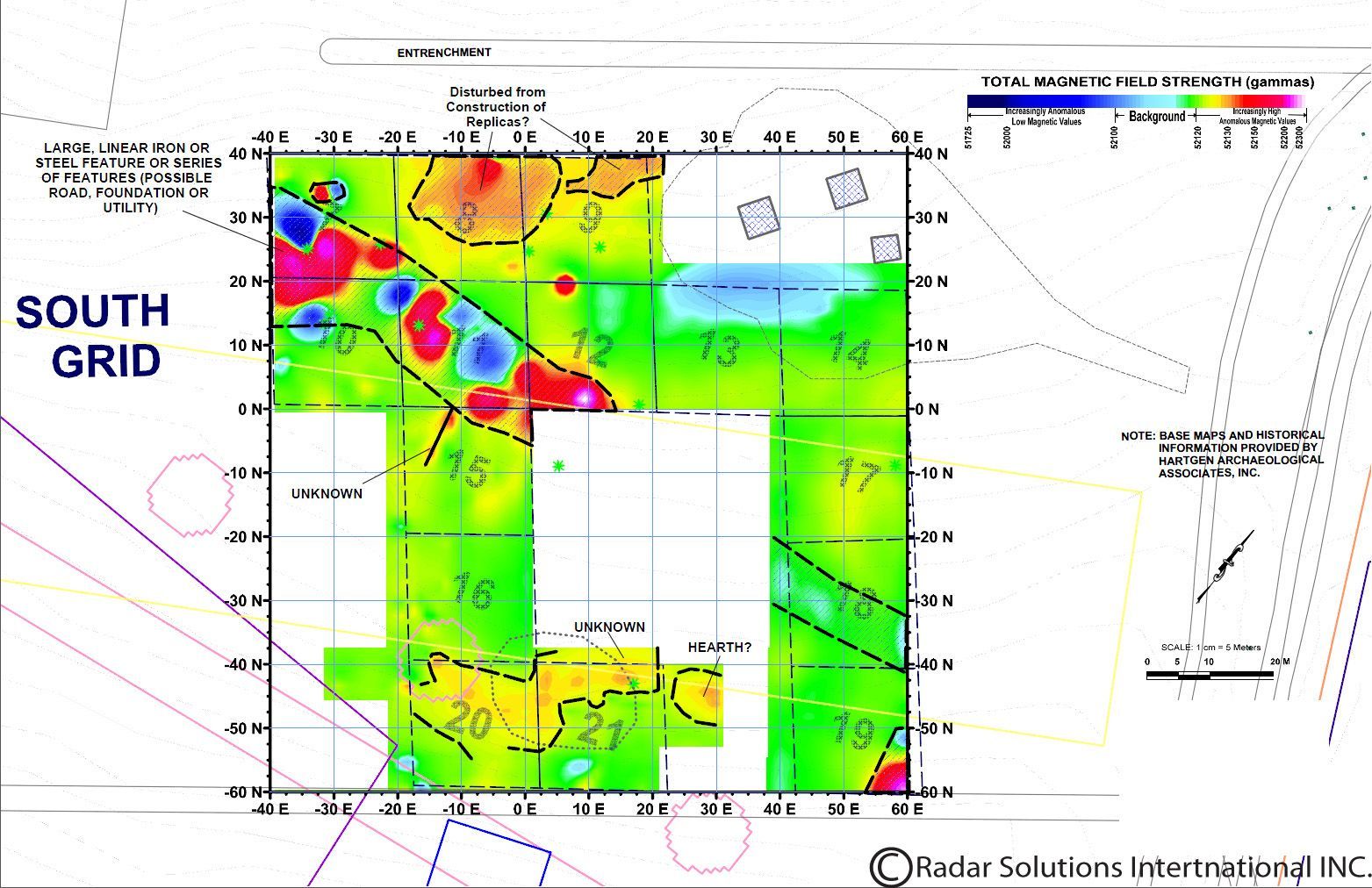
Hartgen Archaeological Associates, Inc. were asked to perform historical background research and a geophysical survey by the National Park Service of Valley Forge, and in August of 2013, Hartgen Archaeological Associates relied on Radar Solutions International, Inc. and our geophysical expertise to perform the survey. Hartgen and RSI teamed up to complete the geophysical survey of over 2.3 acres of land. The survey area was split into two separate areas; north of the tree line and south of the tree line. These two areas were chosen from pre-existing historical maps that showed human activity. To understand the full extent of the sub-surficial features within this area, RSI used a number of methods; ground penetrating radar (GPR), resistance meter, magnetometer, and electromagnetic conductivity.
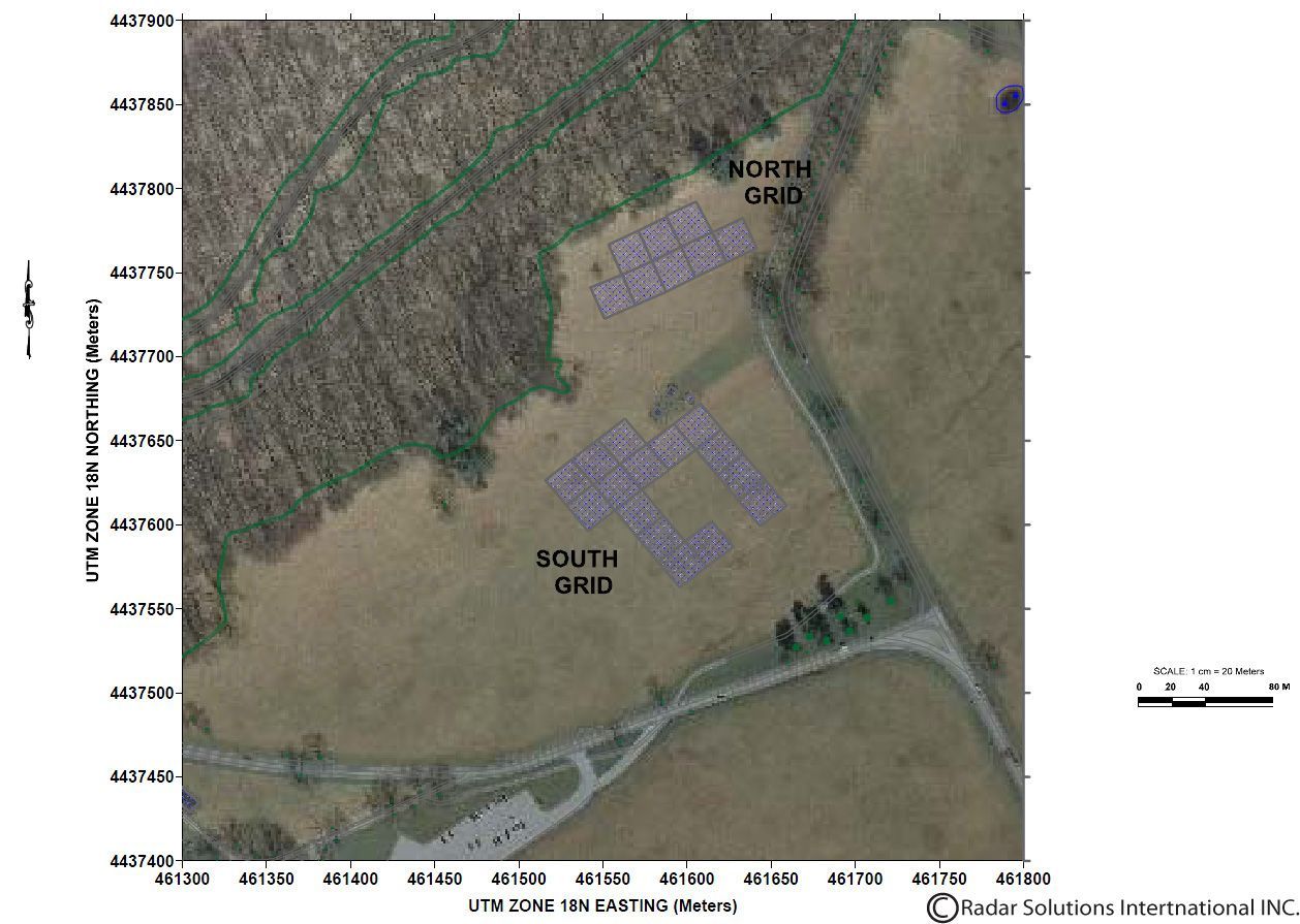
RSI's President and Senior Geophysicist Doria Kutrubes, Geophysicist Amy Ziter and Geophysical Technician Rick Lammey were on site to complete the survey. Accompanying the RSI team was Shaffer Miller from Hartgen and Valley Forge Park Archaeologist Liza Rupp to designate grids and map out the site. Above is a map of the survey area.
RSI used GSSI's SIR-3000 with both 400 MHZ and 900 MHz antennas, which had an average penetration of 7.5 ft. and 4.2 ft. respectively. The GPR data shows a of broad reflectors crossing the site at a variety of depths. There is some possibly that these broad zones are the former roads used for mining. The GPR data is further supplemented by the magnetics and resistivity data sets.